Nonprofit Partner Maps is a pivotal addition to our platform, improving equitability and efficiency of food recovery. But we’re not stopping there. We’re currently developing a way to leverage this database, along with external data, to recommend suitable nonprofit partners for incoming food donations to help increase equity and justice when distributing donated food.
We’re excited to see how these improvements will affect the equitability of our impact and the distribution of rescued food across the communities that our partners serve.
Problem
When a food donor has food that needs to be rescued, time is of the essence. Throughout the day, staff at food recovery organizations who coordinate rescues (called dispatchers) are continuously multitasking, arranging the pickup and dropoff of thousands of pounds of food throughout their community. Finding a nonprofit partner for a donation can sometimes be a challenge, resulting in delays that reduce the organization’s capacity, and induces stress on staff who are often already stretched thin. And for new staff, identifying appropriate NPPs can be a steep learning curve.
Naturally, rescuing the food is the first priority. On a particularly busy day, calling on a nonprofit partner that is known to be consistently responsive to phone calls can get a food donation placed quickly. But leaning on this smaller subset of reliable or communicative NPPs leaves out others that may have irregular hours or couldn’t accept the type of food that was offered last time they were called. When this becomes common practice, it diminishes the equitability of food rescue, serving only community members within reach of the smaller subset of NPPs.
It would be time consuming for dispatchers to gauge every donation against nearby NPPs’ operating hours, storage capacity, donation history, and accepted foods. But with the right improvement to the Food Rescue Hero platform, we could make it easier for these food recovery dispatchers to direct food more equitably in their community.
Research
In preparation for developing a solution, we conducted interviews with Food Rescue Hero Partners – the organizations that use the Food Rescue Hero technology. Through these interviews, we asked our partners for the factors that would help them distribute food more quickly, efficiently, and equitably.
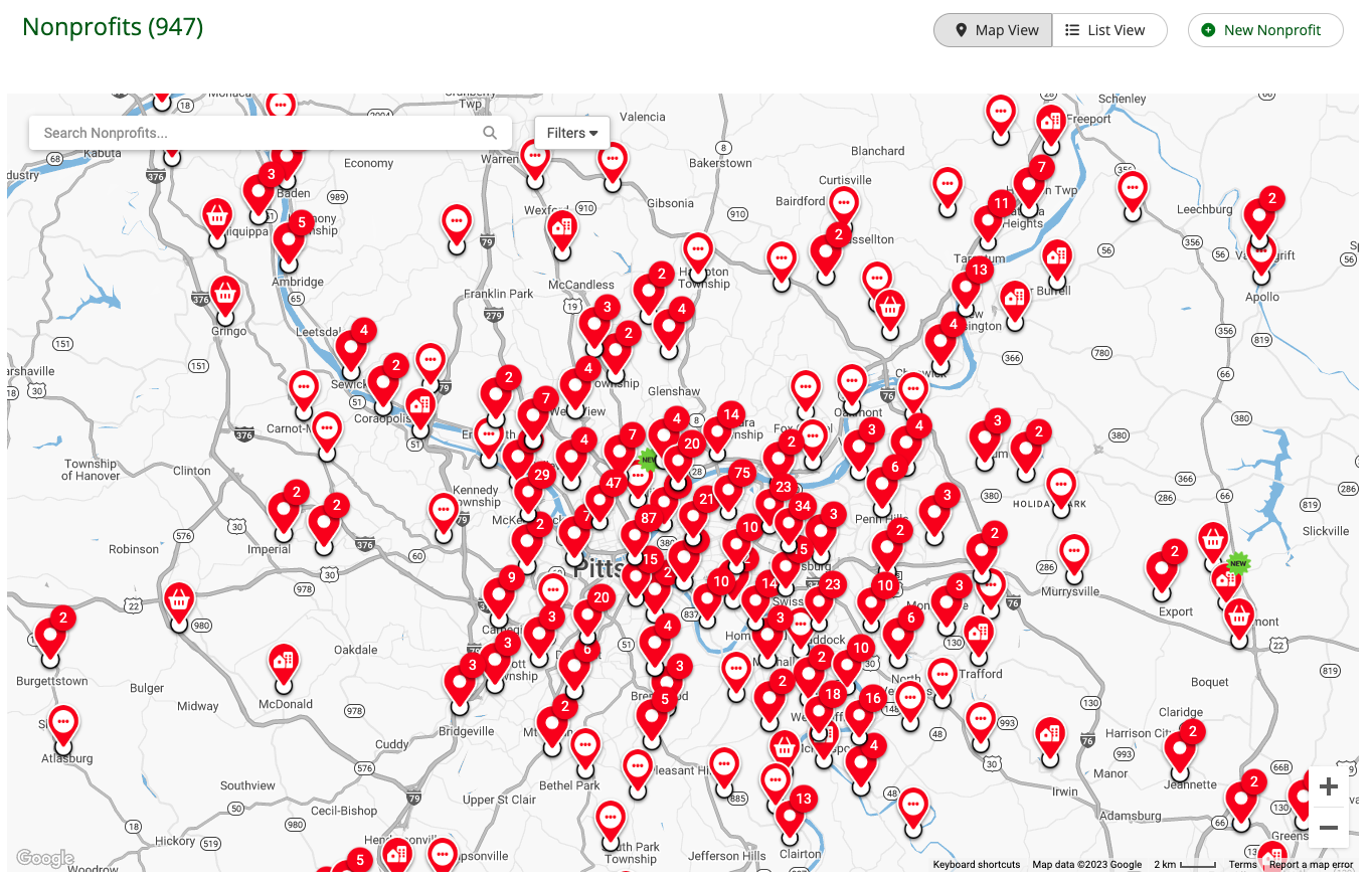
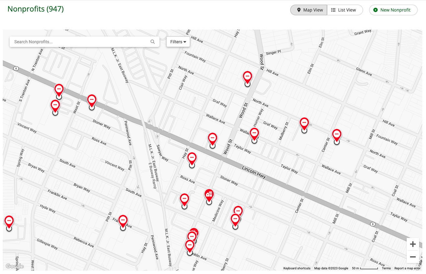
The top unanimous answer: a map view. Instead of scrolling through a list of their current NPPs, our partners reported that seeing these locations plotted on a map would help them more quickly visualize who was available to take donations in specific regions of their communities.
Old List View

New Map View
Our partners also had specific ideas for how the map could help in decision making. For example, they wanted to be able to see which NPPs were “open now”, as well as a search bar to easily find NPPs with multiple locations. They also asked for the ability to filter the map by the food types accepted at the location; this would help ensure that the incoming food goes to an NPP who has the necessary storage capacity (like a fridge or freezer).
From this feedback and more, we collected the most important criteria for a map feature.
Solution
Now available to all current food rescue organizations using the Food Rescue Hero technology, our NPP Maps feature not only visualizes all current NPPs on their regional map, but includes pertinent data, helping dispatchers make an informed decision that considers the needs of the community.
Using NPP Maps is simple:
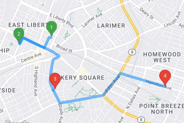
When a dispatcher receives a call about available food, they can zoom into the donor’s neighborhood and see all of the nearby NPPs.
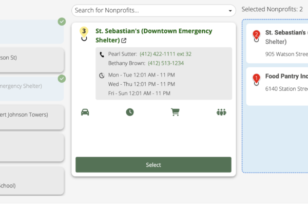
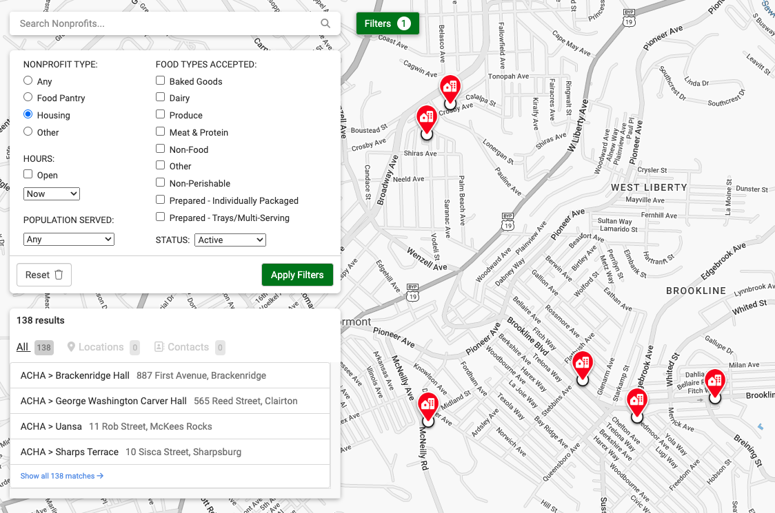
The pins shown on the map can be filtered by a few critical factors.
In addition to the food types accepted at the location, dispatchers can filter the map by the size of the nonprofit, which is especially important information when placing a large food donation.
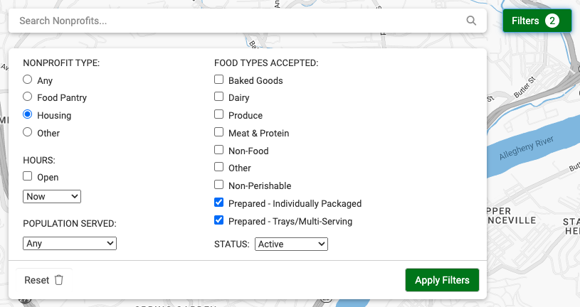
The map can also be filtered by the NPP category—whether it’s a housing site or a food pantry model.
Additional Advantages
Occasionally, a rescue needs to be rerouted, and this can sometimes happen when a volunteer already has the food in their car. With NPP Maps, the dispatcher can quickly find options for rerouting the food within the vicinity of the volunteer.
Long term, NPP Maps will also help food recovery organizations identify service gaps simply by observing where on the map there are few (or no) recipients in the database. These gaps indicate areas where the food recovery organization may need to seek out partnerships.
Future
Nonprofit Partner Maps is a pivotal addition to our platform, improving equitability and efficiency of food recovery. But we’re not stopping there. We’re currently developing a way to leverage this database, along with external data, to recommend suitable nonprofit partners for incoming food donations to help increase equity and justice when distributing donated food.
We’re excited to see how these improvements will affect the equitability of our impact and the distribution of rescued food across the communities that our partners serve.
*Nonprofit partners are the organizations that receive food from a food recovery organization, and act as a distribution point to the families and individuals that they serve.